Journey of Utility Service Locating: Hidden Histories
Utility service locating, a practice integral to modern infrastructure development and maintenance, boasts a rich history that mirrors human civilization's evolution.
This exploration delves into the depths of utility locating and mapping, unraveling its origins, technological advancements, and cultural significance.
The journey from ancient times to contemporary practices highlights not just technical progress but also an enduring connection to the land and its resources.
Understanding the definitions of Utility Locating and Mapping
The essence of utility locating is rooted in the Latin words "Utilis" (useful) and "locus" (place), while mapping draws from "Mundus" (world), reflecting the endeavor's global significance.
These practices, at their core, involve identifying and representing the positions of subterranean utilities in a manner that is beneficial and informative.
Aboriginal Mapping with Meaning.
Long before the advent of modern technology, the Aboriginal peoples of Australia were creating intricate maps of their environment.
These maps, embedded in rock art dating back 30,000 years, are among the earliest forms of utility mapping.
They not only charted physical landscapes but also encoded vital survival information, cultural narratives, and spiritual beliefs through symbols representing water sources, animal tracks, and sacred sites.
This holistic approach to mapping underscores the interconnectedness of people, place, and nature.

Songlines: The Living Maps
The Aboriginal innovation extended to "Songlines," oral maps sung to navigate the vast Australian landscape.
These songlines, more than just navigational aids, were mnemonic devices that preserved knowledge across generations, illustrating the fusion of art, memory, and geography in ancient utility locating practices.
The Beginning of Electromagnetic Induction Locating.
The scientific groundwork for modern utility locating was laid by Michael Faraday's 1831 discovery of electromagnetic induction.
This principle became the backbone of techniques to locate underground pipes and cables.
The first electromagnetic induction cable locator, a simple wooden device wrapped with a coil, represented a leap towards the technology we recognize today.
Technological Evolution: From Wooden Devices to Advanced Locators
The journey from Faraday's discovery to the sophisticated locators of the 20th century is marked by continuous innovation.
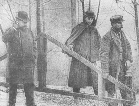
Early 20th-century devices like the Sharman Main Finder made utility locating more accessible, though the technology was primitive by today's standards.
The advent of more portable and precise locating equipment was driven by the challenges of urban development, particularly in dense cities where underground utilities crowded closely together.
World War II and Beyond: The Drive for Precision
The period leading up to and following World War II saw significant advancements. German engineers, grappling with the complexities of urban infrastructure, developed lower frequency, higher-powered locators.
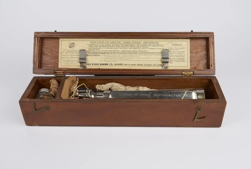
In the United States, Dr. Gerhard Fisher's Metallascope set new standards for buried utility detection. Bell Laboratories' introduction of the depthometer in 1964 further refined the accuracy of utility locating, allowing for depth measurement alongside positional mapping.
The Legacy of Utility Locating: A Tapestry of Innovation and Tradition
The history of utility locating is a testament to human ingenuity and our relationship with the environment.
From the ancient Aboriginal maps to the high-tech locators of today, this journey reveals a continuous thread of innovation woven into the fabric of societal development.
As we look to the future, the lessons of the past remind us of the importance of understanding and respecting the hidden networks that sustain our world.
In the narrative of utility service locating, we find a fascinating confluence of technology, culture, and history.
This journey, marked by milestones from ancient rock art to modern electromagnetic locators, underscores the evolving relationship between humanity and the landscape we inhabit.
As we continue to chart new paths and develop technologies, the legacy of those who first mapped the unseen world beneath our feet remains a guiding spirit, inspiring us to navigate the complexities of the modern world with wisdom and respect for the past.